
MAPS |
Mission, Vision and Leadership Team | Bayfield Area Trails
Hiking Bayfield Wi | Bayfield Area Hiking Trails | Mountain Biking | Skiing | Snowshoeing | Best Hiking in Bayfield | Hike Bayfield

|
We've put together a reference library of maps addressing trails and trail projects. We will update this page as projects and trails continue to develop.
NOTE: Some links are larger pdf files and may take extra time to load. |
|
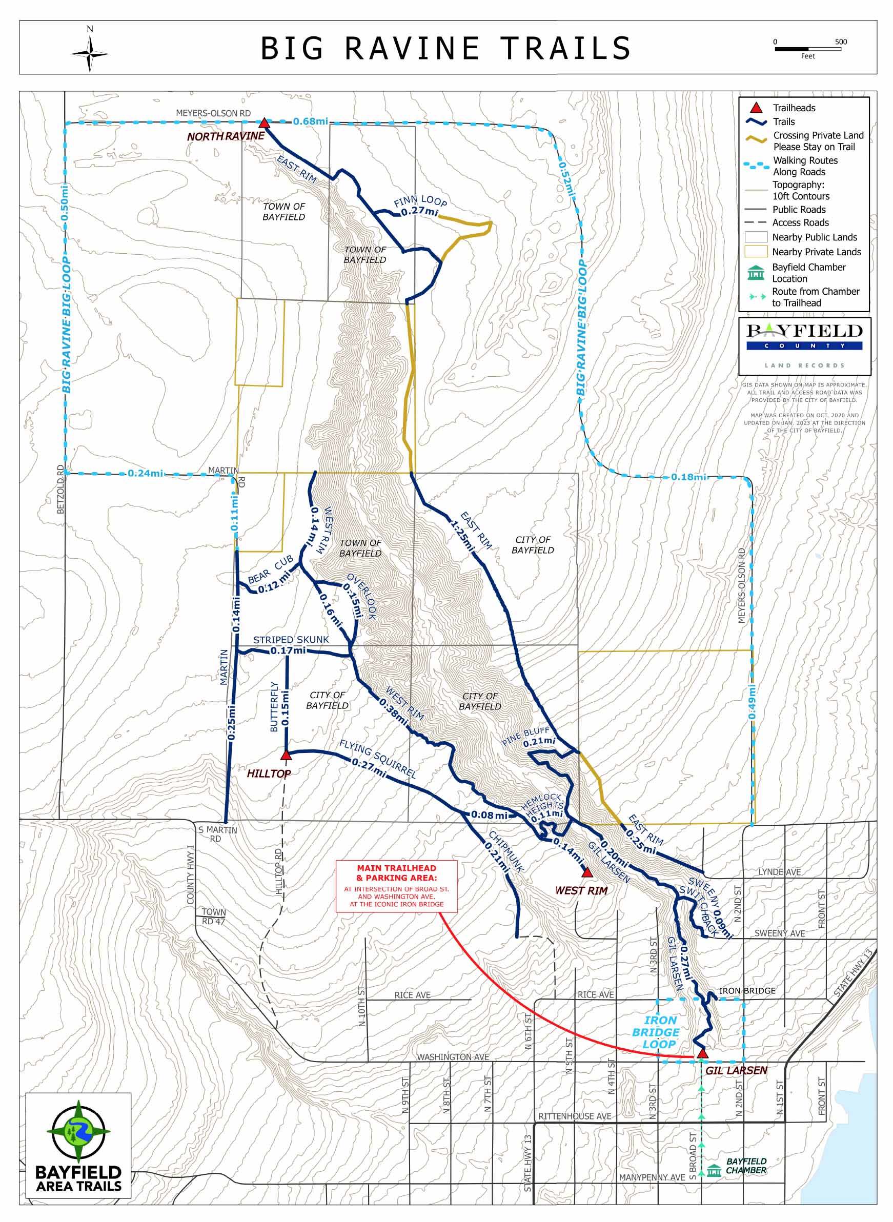
Big Ravine Headwaters Trails
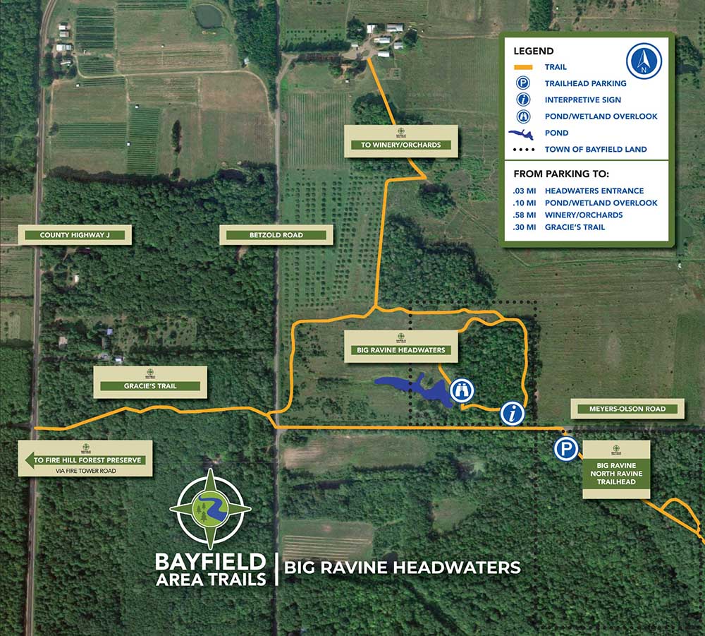
Click image to view map.
|
|
|
City of Bayfield Public Land and Parks
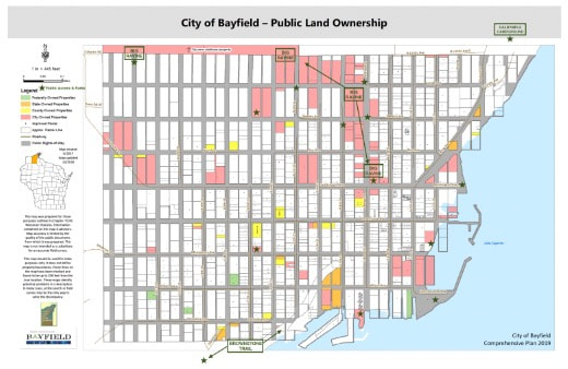
Click image to view map.
|
City of Bayfield Topography
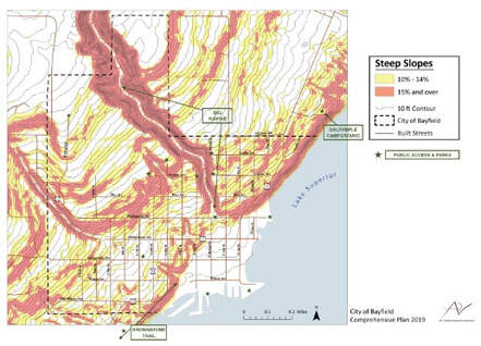
Click image to view map.
|
|
Fire Hill 2023 Project Maps
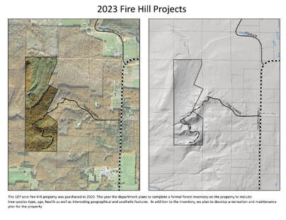
Click image to view map.
|
Jerry J Jolly 2023 Projects
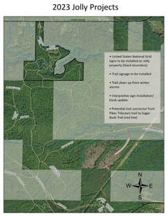
Click image to view map.
|
|
Lost Creek Falls 2023 Projects
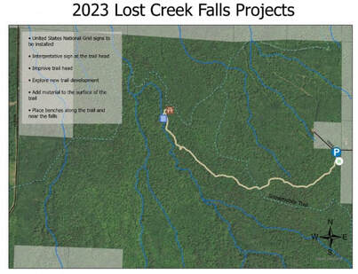
Click image to view map.
|
Siskiwit River Preserve 2023 Projects
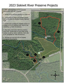
Click image to view map.
|