BLOG |
0 Comments
You can check it all out by reading the 2023 Annual Report. The report includes:
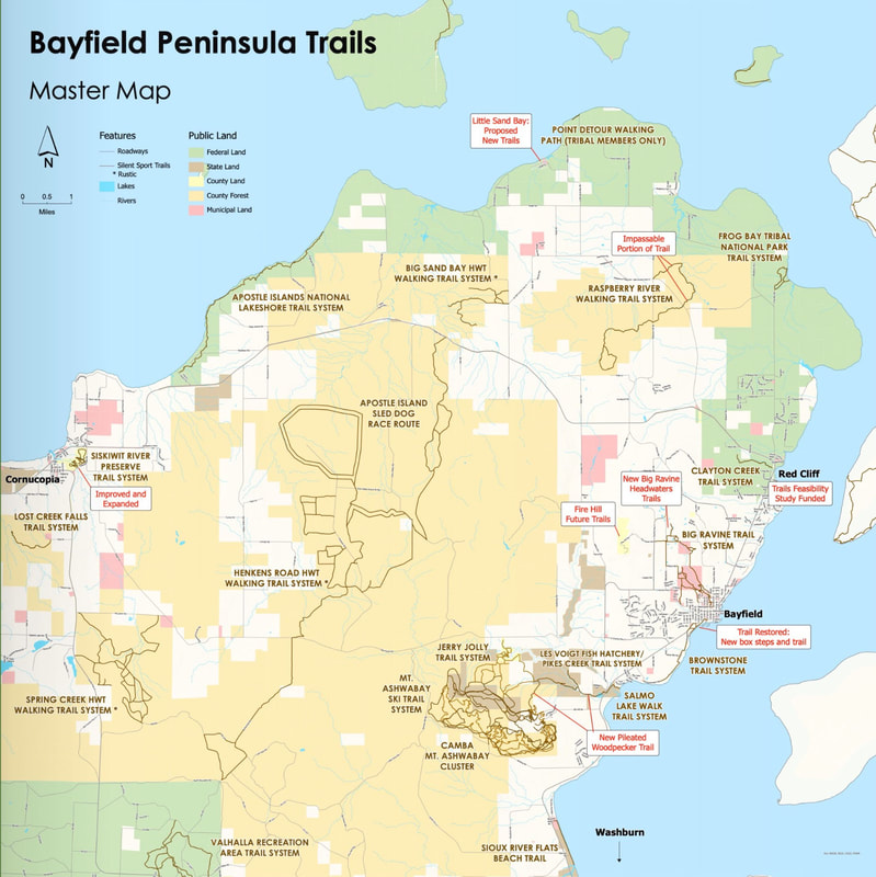 Click/tap map to enlarge.
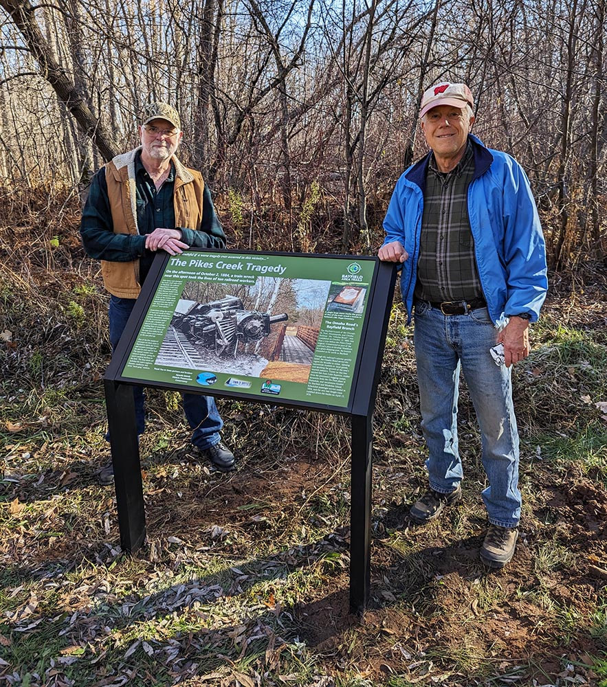
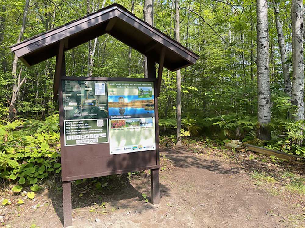
 New interpretative sign at the Salmo trailhead. Click image to enlarge.
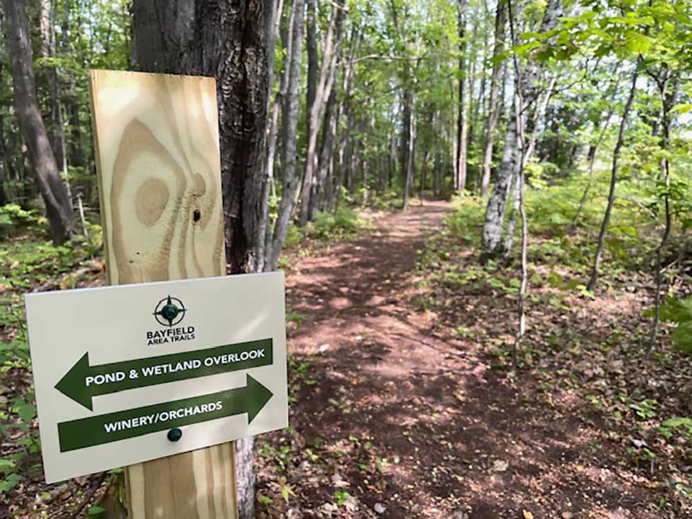
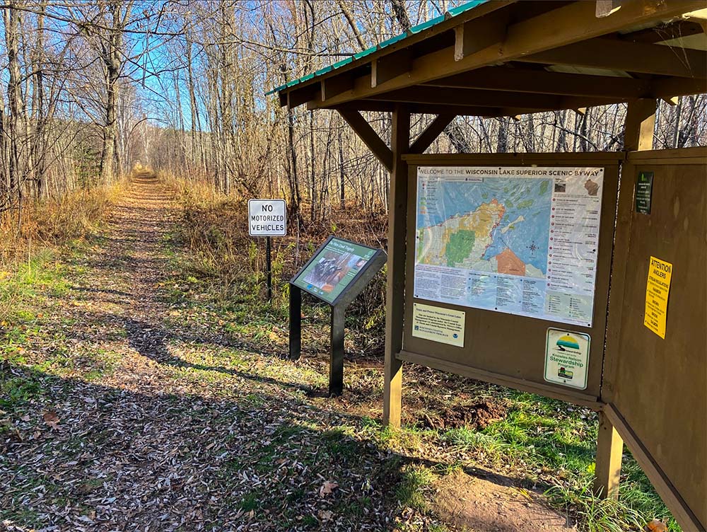 The Salmo trailhead. Click image to enlarge.
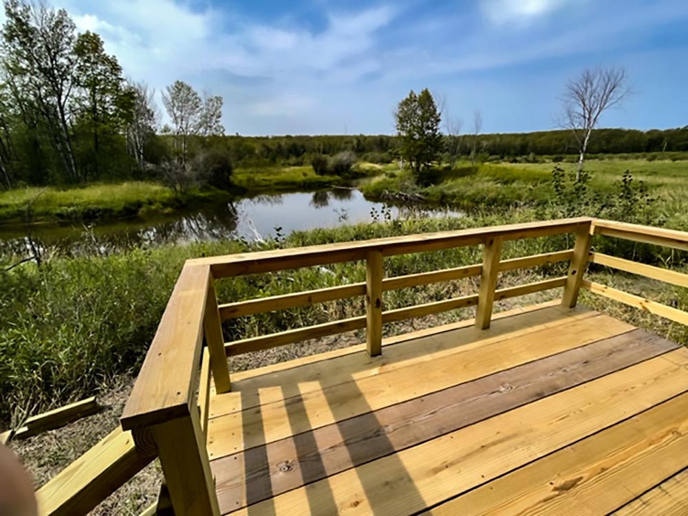
 Big Ravine Headwaters Overlook
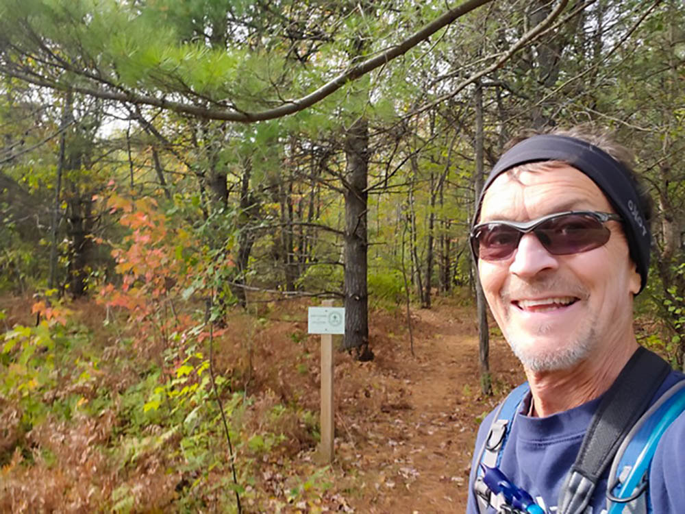
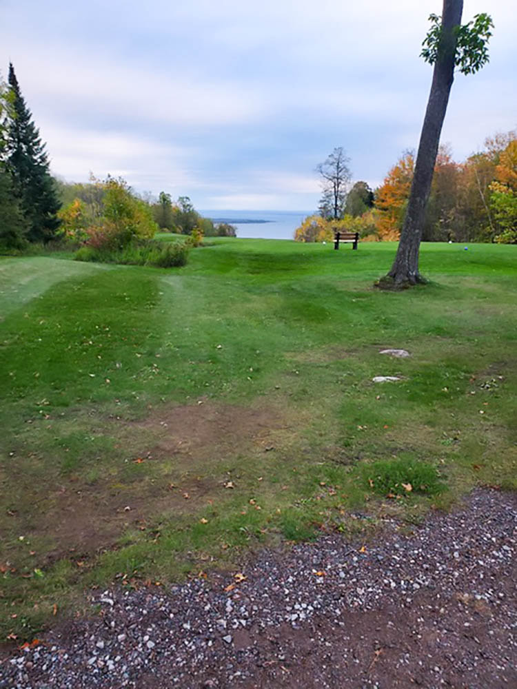
Hiking the rest from Jerry Jolly out to Star Route is always an incredibly beautiful stretch of trail, too. Then the walk home from there on a colorful fall day was fun, ending with a beautiful overlook of Lake Superior once again. What a place to call home!!! Ted
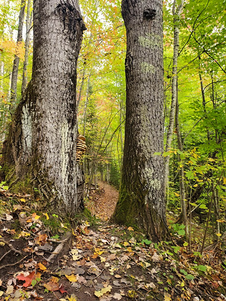
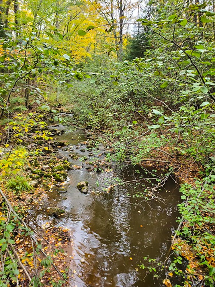
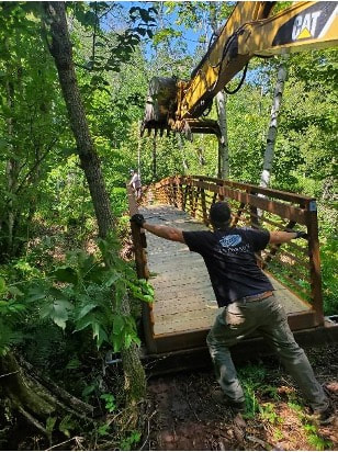
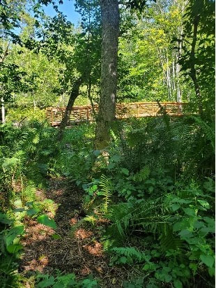
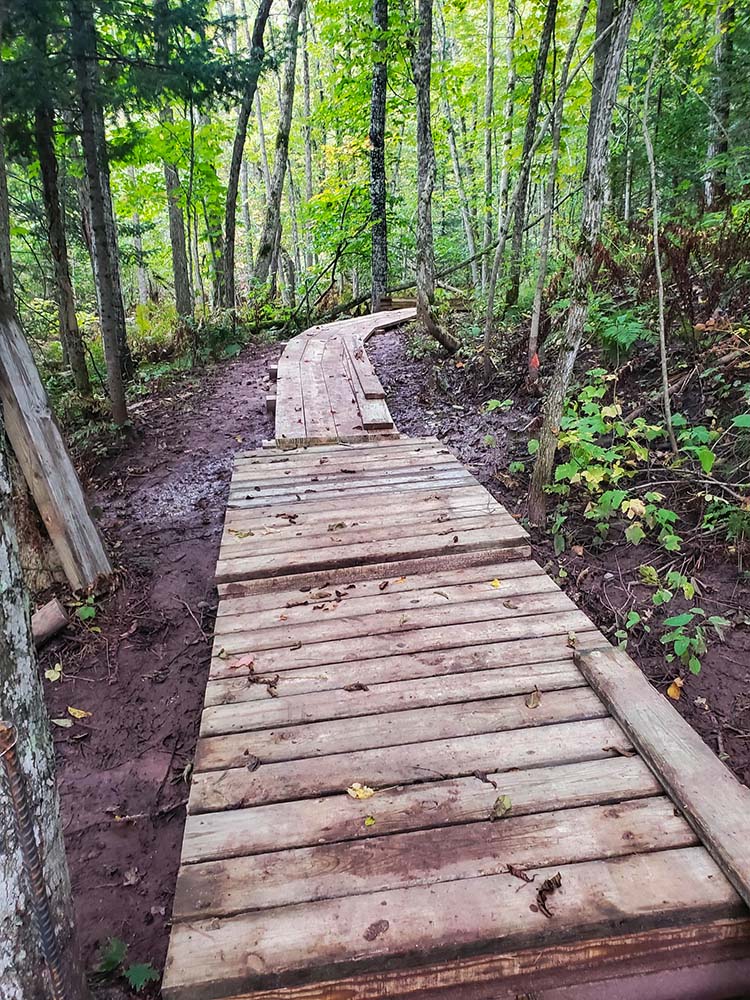
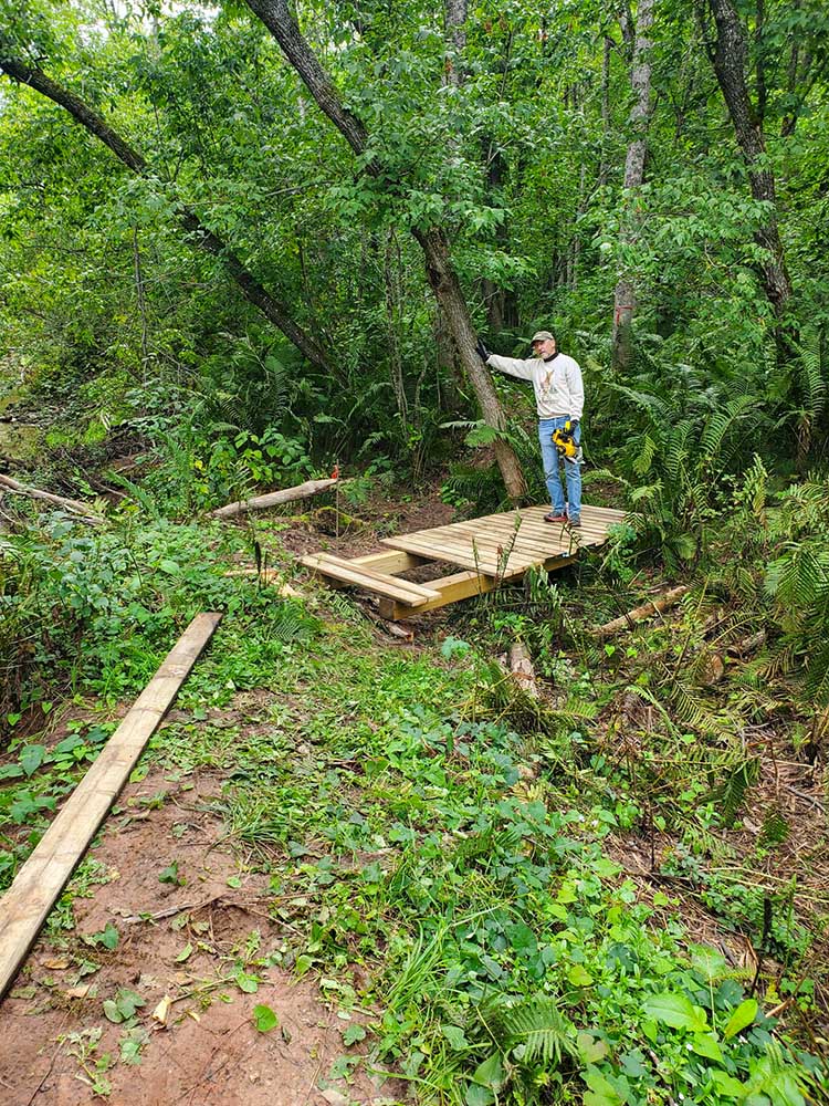
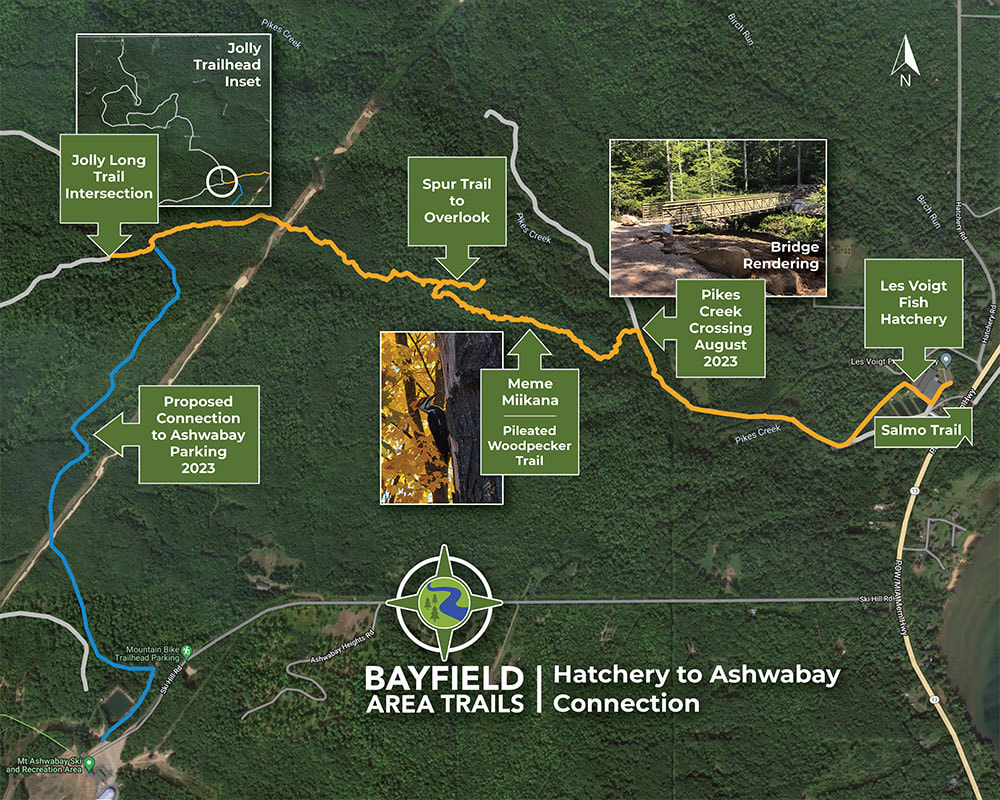
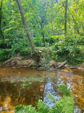
By Ted May 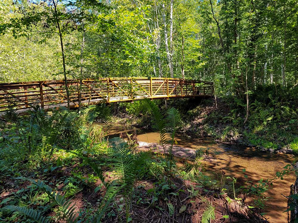 The new bridge over Pikes Creek. The long-awaited bridge across Pikes Creek is now in place, making our new trail accessible. The trail takes us from the Les Voigt State Fish Hatchery up to the Jolly Long Trail (part of Ashwabay cross-country ski trails) – with a connector soon linking directly to the Ashwabay/Big Top Chautauqua parking lot. The 1.3-mile-long trail starts off through the lush bottomlands along Pikes Creek, then we cross the new 54-foot bridge, and continue through fern-lined trails across a short footbridge and 150-feet of boardwalk and box stops. The trail then gradually climbs up the side of a ridge above a small tributary to Pikes Creek. At the top of this ridge, a right-hand turn takes you to an overlook; or turn left and head through the woods toward the Jolly Long Trail. The entire way is lined with beautiful wildflowers and towering trees, birds, quiet and peace; a delight to have in our trail system!
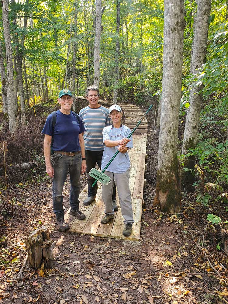
Some additional work is planned to fully secure the bridge and its footings for the long term. And, we have a bit of rehabilitation to do along the path on the hatchery-side of the trail: hoping to get this work done by November.
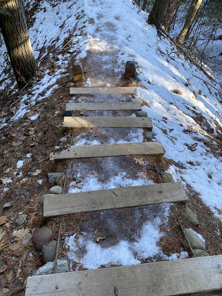
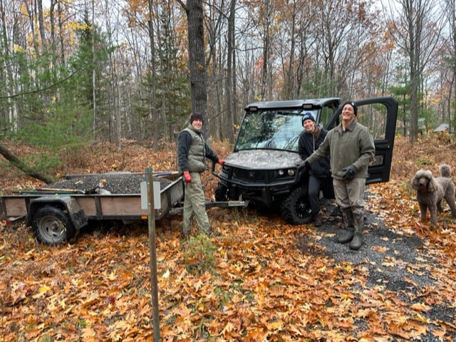
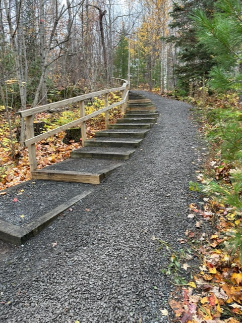
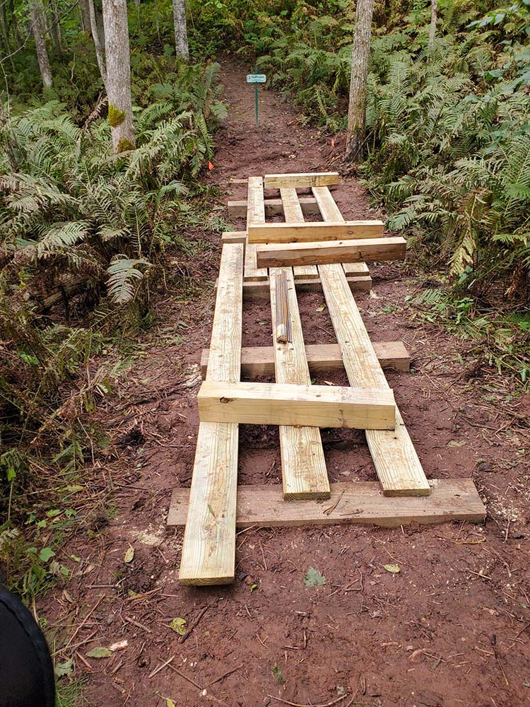
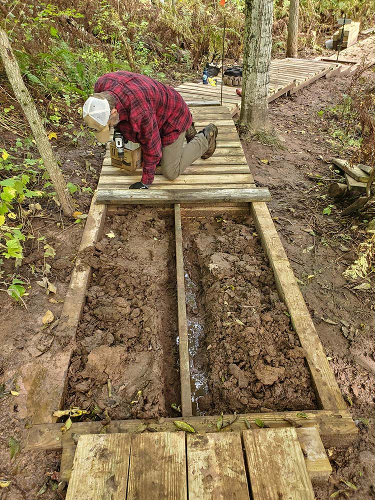
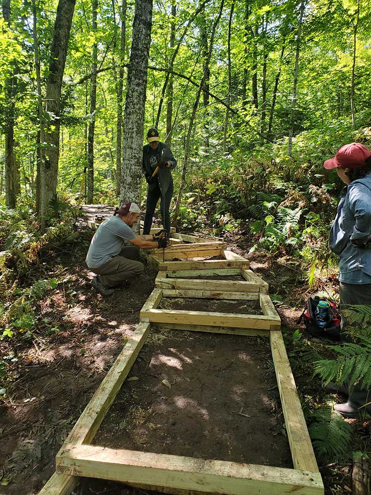
After an excellent foot-bridge was built by Mike Kinnee, our next major project was the construction of the boardwalk across the floodplain and seep area, plus the box steps between them. John Ipsen and Kris Wegerson chain-sawed the 12-foot 8x8s and 6x6s into 4-foot or 3-foot sections for different parts of the project. Gene Lemmenes provided the main work cutting and pounding in the supports for the boardwalk over the floodplain; then we put in the initial box steps leading up the adjoining hill. We used some of the box-steps pre-assembled by Mark Filonowich and Colleen Trumper, while others were re-designed to fit the specific needs of the rising and curving slope. It was one long “figure-it-out” effort, as we moved uphill to maneuver around tree roots and sloping lands. Quite the fun project, some design work by Steve Vircsik and Jeff Nelson, with others also pounding rebar along the way. The upper deck tops were designed and installed by Rich Ryan. During the box step construction, crew members also grubbed out young aspens that had sprouted in the tread of the upper trail sections due to lack of use over the summer. Sean Reagan mowed the trail across the top of the plateau.
It is fun to see the collective wisdom (well, we are hoping they work well) and final outcome of these adjusted steps. The last stage of the box steps and 60-foot boardwalk over an extended seepage area (you will note this is always wet!) was a project that involved Gene, Jeff Nelson, Tina Martin, Kathleen Russell, Doreen Conrad, Cyndi Taylor, Neil Howk, Rich and Janel Ryan, Kate Kitchell and Mike Eldred. Gene’s angled cutting was wonderful to have for smooth corners along the way. Rich Metcalfe was especially helpful with pounding rebar and screwing in deck-boards.
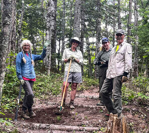
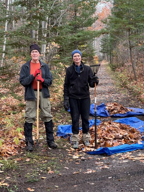
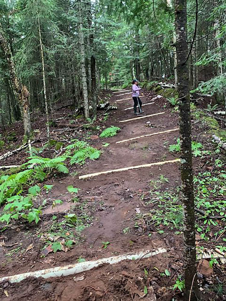
I may have missed others who helped along the way, but I know every one of them was exceptionally fun, and I enjoyed working with each of them. Thanks, thanks and more thanks to all the hard-working Bayfield Area Trails volunteers and the many donors who made the bridge and project possible. Now it’s time to enjoy this glorious new trail through some exceptionally beautiful woods. 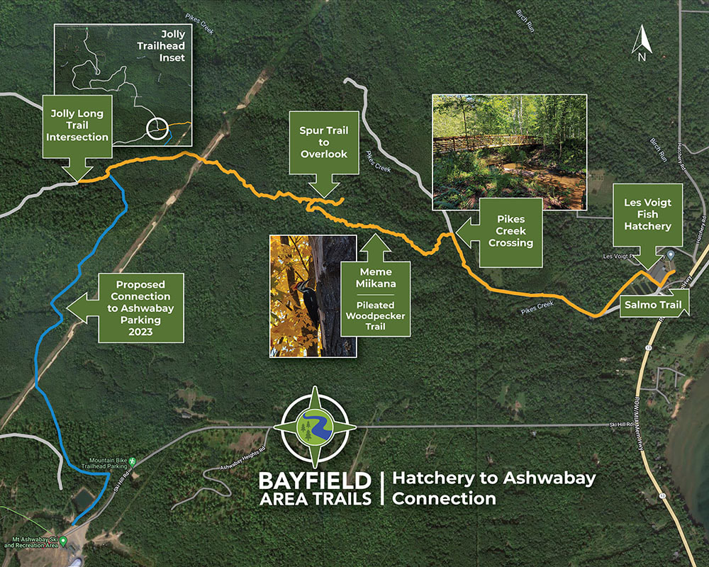 Full trail map showing the future connection to Mt. Ashwabay. 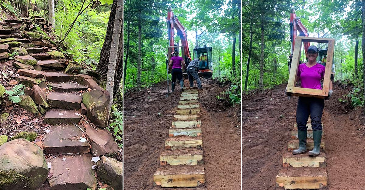 LEFT: New stone path down to the west side of the Siskiwit River created by Will Krift & Trails Anonymous. CENTER & RIGHT: West side stairway construction. Bayfield County has been working hard to keep improving this beautiful preserve along the Siskiwit River while continuing to utilize our volunteers. Recently, the west side of the Preserve had some beautiful trails constructed by Trails Anonymous, adding more opportunities to view the river and extend a small loop trail back to the main west trail. Be sure to check out the intricate stonework! In addition, the County and BAT/CTC volunteers installed wood/gravel steps down a hillside and diversion features to minimize erosion.
A small new bridge will be installed by the County at the lowest spot on the trail to finalize the ski trail for winter. This will allow the groomer to continue grooming the meadow trail and to now move into the forested trail and orchard areas, expanding the ski trail system.
A huge shout-out to Bayfield County for making these fabulous improvements and expanding our recreational opportunities near the Cornucopia area! Lindley Mattson and John Mesko, Bayfield County, and the Bayfield County Highway Department.
Click images to enlarge.
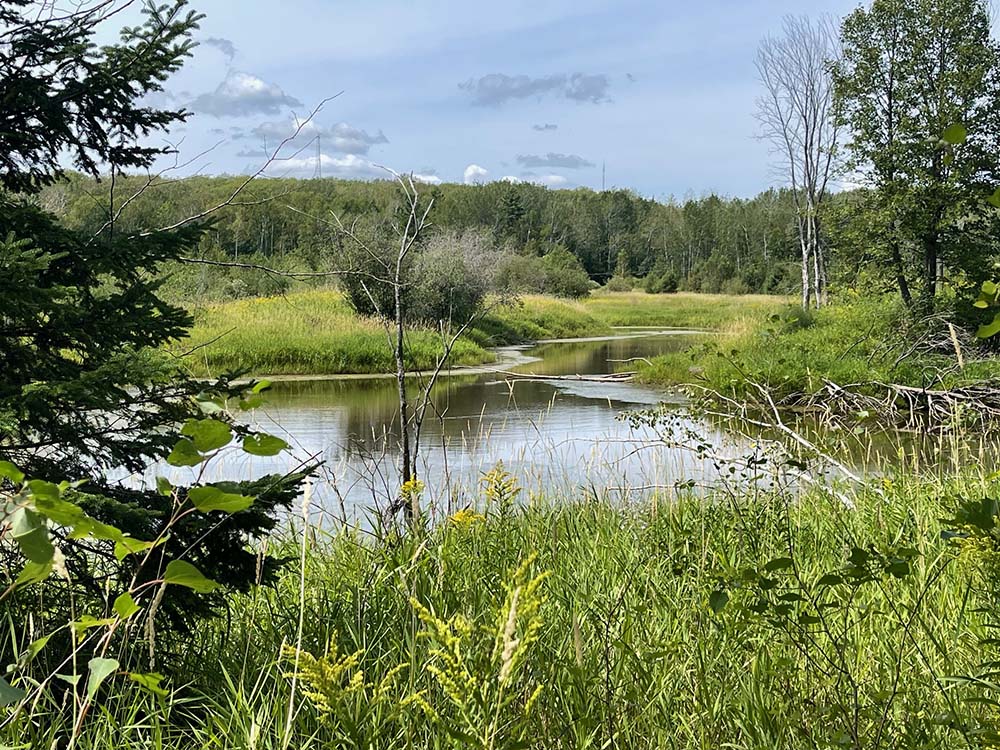
A spur trail from the north side of the loop leads hikers through meadows and orchards to the Bayfield Winery & Blue Ox Cidery where one can relax with refreshments during business hours and savor a beautiful rural landscape panorama. FOR SAFETY: The portion of the trail leading to the winery crosses private farmland. Please stay on the marked trail and keep all pets leashed as there may be livestock present and electrified fencing on the trail perimeter. 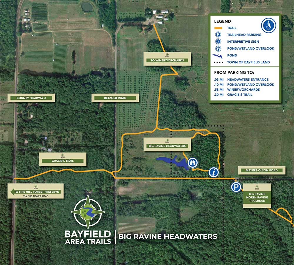 Big Ravine Headwaters Map. Click image to enlarge. Along the route, walkers will experience an interesting variety of habitats and vistas. The trail begins in darkened forest with carpets of wintergreen on the forest floor and soon leads to sunny, wet meadows enjoyed by sandhill cranes. Further along the trail is a tranquil view of a pond once worked by beavers but now the home of river otters, turtles, kingfishers, and waterfowl. There are more distant views of the surrounding hills that hug this trail including orchard-covered slopes to the north and the looming Fire Tower Hill rising to the west. Slideshow - Hover for controls. While this wetland basin provides a variety of critical ecological services from flood control to wildlife habitat, it is an opportune link to advance recreational opportunities near Bayfield. One can now enjoy a hike starting across from the Bayfield Library on Washington Avenue traveling creek-side in the ravine and ending atop the watershed at the Bayfield Winery & Blue Ox Cidery on Betzold Road close to Highway J, a distance of more than 2 miles.
Come visit the Headwaters Trail, stretch your legs, and appreciate the beauty that this area gives us to enjoy!
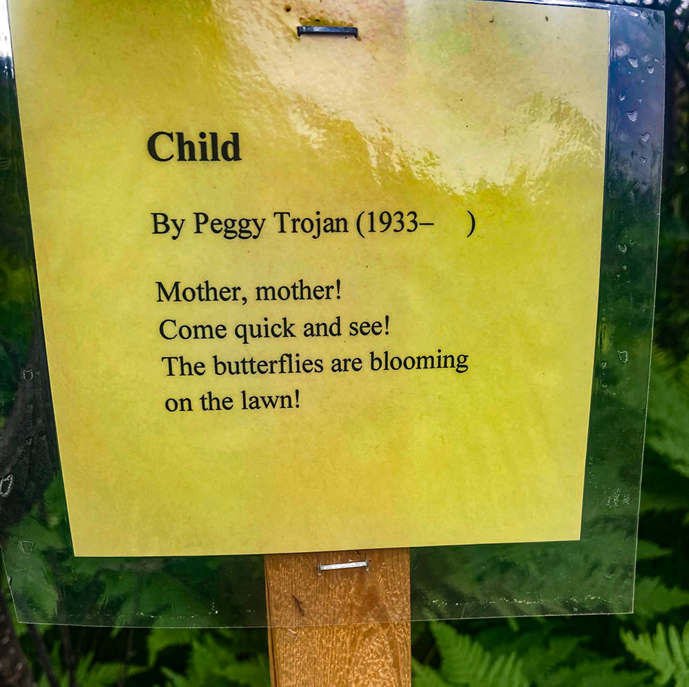
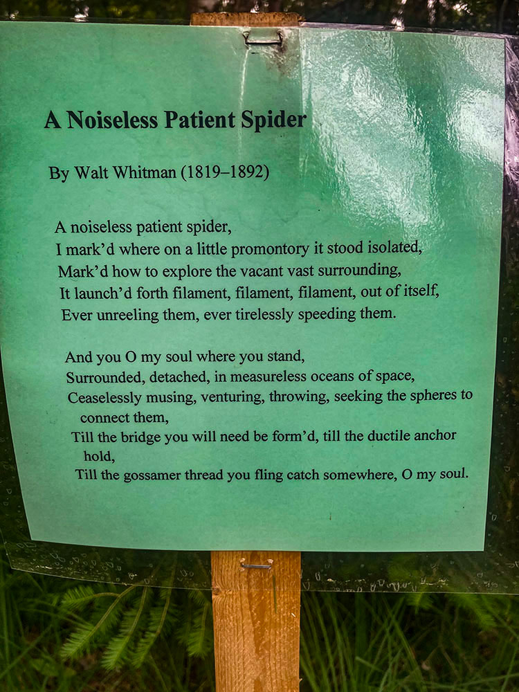
By Lucy Tyrrell - Bayfield Poet Laureate 2020–2021 A poetry trail idea was hatched as a project during my tenure as Bayfield Poet Laureate in 2020–2021. Instead of using a literal walking trail, in coordination with the Bayfield Chamber of Commerce, I organized the first Bayfield Poetry Trail (2021) in which 22 businesses (Bayfield Chamber members) posted poems in their windows. Many shops shared poems related to their business or location. The "trail" lasted for a month from mid-August to mid-September. 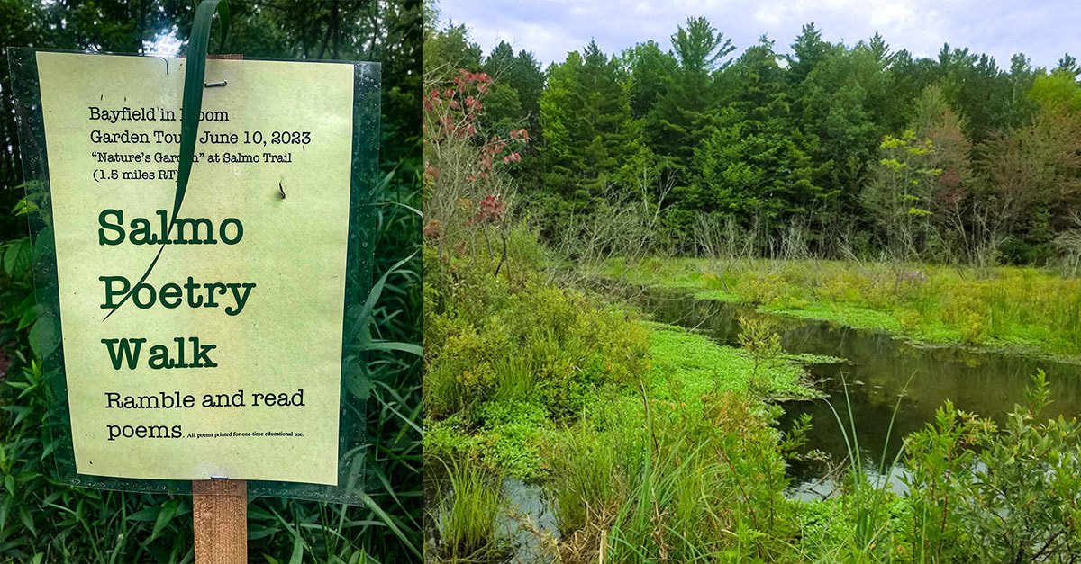 Salmo Poetry Walk. Click image to enlarge. In 2022, the Bayfield Poetry Trail was expanded to include 26 businesses—this time during September to overlap with Art Escape and Bayfield Festival of Arts. Poems from the two past Bayfield Poetry Trails are available for reading in a binder at the Bayfield Carnegie Library, sponsor (with the City of Bayfield) of the Poet Laureate program. I thought it would be good to have garden or flower poems posted on local trails in concert with Bayfield in Bloom. This led me to wonder whether 2023 might be the year to have poems posted during June instead of September. Carol Fahrenkrog, Director of the Bayfield Chamber, suggested that trail poems be part of the Garden Tour and retain the Bayfield Poetry Trail in September.
To give Salmo Trail users a chance to read about nature and blooms, I placed eight poems along the trail for the week of Bayfield in Bloom, listed as Stop #16 for the Garden Tour (June 10, 2023). Some poems were written by contemporary poets, while others were penned centuries ago.
If you did not get a chance to experience this year’s poetry on the Salmo Trail, maybe there will be a repeat with different poems in 2024. The third annual Bayfield Poetry Trail will be staged for Art Escape, September 9-17, 2023 and poems will be posted for the entire month of September. Twenty-six businesses have signed up to participate. You can view a map of the poetry trail in the Art Escape brochure. The poetry trails and walks have been a group effort. Thanks to all!
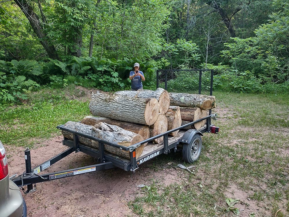
The bridge across the creek is coming soon – to be installed in mid- July by the Anderson Bridges company (you’ve seen their bridges around if you’ve been on trails in northern Wisconsin and elsewhere). Several volunteers have already cleared the bridge access, including cutting down large black ash trees, in preparation for the bridge installation. Brit's Tree Care removed the more challenging willow and box elder trees overhanging the bridge site to ensure that they don’t harm the white and yellow birches on the creek bank.
The new trails will be available for hiking and snowshoeing. Due to the DNR’s special management of the Pikes Creek Fisheries Management Area, no bikes are allowed. Meme will be closed during the mud-season to keep the trail in good condition through these sensitive areas. Enjoy! |